
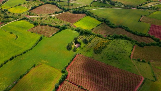
Measuring land has always been an essential task in agriculture, construction, real estate, and land management. Traditionally, this required professional equipment, technical expertise, and a fair amount of time. Today, however, technology has changed the game. With just a smartphone in hand, anyone can measure distances, calculate land areas, and map terrain with impressive accuracy.
Land measurement apps use GPS, satellite imagery, and advanced algorithms to turn your phone into a powerful surveying tool. Whether you are a farmer estimating field size, a real estate professional evaluating property boundaries, or a homeowner planning a project, these apps provide quick, accessible solutions without complex setups.
In this guide, you’ll discover how land measurement apps work, what features truly matter, and which types of apps are best suited for different needs. By understanding the strengths and limitations of these tools, you’ll be able to choose the right option and use it with confidence in real-world situations.
What Are Land Measurement Apps?
Land measurement apps are mobile applications designed to calculate distances, perimeters, and surface areas of land directly from a smartphone or tablet. They rely primarily on GPS positioning, digital maps, and sometimes satellite imagery to provide measurements in real time.
Instead of using physical measuring tapes or specialized surveying instruments, users can simply walk around the perimeter of a land parcel or mark points on a digital map. The app then processes those points and instantly delivers measurements in units such as square meters, hectares, acres, or square feet.
These apps are especially popular because they democratize access to land measurement. Tasks that once required professional surveyors can now be performed quickly for planning, estimation, or preliminary analysis, saving both time and money.
GPS Fields Area Measure
GPS Fields Area Measure is one of the most popular and widely used land measurement apps in the world. Its main strength lies in simplicity combined with reliable GPS-based accuracy. The app allows users to measure land by physically walking around the perimeter or by marking points directly on the map.
This app is especially popular among farmers, landowners, and real estate professionals because it supports multiple measurement units, including hectares, acres, and square meters. Users can save multiple fields, name them, and revisit measurements later, which makes it practical for long-term land management.
Another strong feature is offline functionality. Once maps are loaded, measurements can be performed without an internet connection, which is crucial in rural areas. While it is not intended to replace professional surveying equipment, GPS Fields Area Measure is excellent for planning, estimation, and daily operational decisions.
Planimeter – GPS Area Measure
Planimeter is a land measurement app that stands out for its precision when working with maps and satellite imagery. Instead of relying solely on walking the perimeter, users can draw boundaries directly on the map by placing points manually.
This makes Planimeter ideal for situations where physical access to the land is difficult or impossible. It is widely used by architects, engineers, real estate agents, and researchers who need fast, remote measurements.
The app supports a wide variety of units and allows users to export measurements in different formats. Its interface is clean and intuitive, making it accessible even for beginners. Planimeter is especially effective for preliminary studies, land comparisons, and presentation-ready visuals.
Land Area Calculator GPS
Land Area Calculator GPS focuses on speed and ease of use. It is designed for users who want quick results without navigating complex menus or advanced settings.
With this app, users simply walk around the land boundary while the GPS records points automatically. Once completed, the app instantly calculates the total area and perimeter. It also allows manual point editing for better accuracy.
This app is particularly popular among farmers, landscapers, and contractors who need fast estimates on-site. While it does not include advanced GIS features, its straightforward approach makes it extremely efficient for everyday use.
Geo Measure Area Calculator
Geo Measure Area Calculator is known for its flexibility. It allows users to measure land both by walking the perimeter and by selecting points on the map. This dual approach makes it suitable for a wide range of use cases.
One of its standout features is real-time distance tracking, which is useful for measuring roads, fences, or irregular shapes. The app also supports multiple measurement units and offers simple export options.
Geo Measure Area Calculator is commonly used by students, survey assistants, and professionals who need a versatile tool without a steep learning curve. Its balance between functionality and simplicity makes it a reliable choice.
Field Area Measure Pro
Field Area Measure Pro is a more advanced option designed for professional and semi-professional users. It offers high-precision GPS tracking and enhanced boundary correction tools.
This app allows users to save detailed field profiles, including notes and labels. It is especially useful in agriculture, where managing multiple plots is common. Users can easily switch between fields and compare measurements over time.
Field Area Measure Pro also supports offline usage and data export, making it suitable for professional workflows. While it may require a bit more familiarity to use effectively, it delivers strong performance for users who need more control and accuracy.
Map Area Calculator
Map Area Calculator focuses heavily on map-based measurement rather than physical walking. Users place points on satellite imagery to outline land parcels and instantly receive area calculations.
This app is ideal for urban planning, real estate evaluation, and research purposes. It is also useful for measuring land in distant locations where GPS walking is not feasible.
Map Area Calculator supports multiple map styles and unit conversions, making it flexible for international use. It is best suited for users who prioritize remote measurement and visual clarity.
GPS Land Measurement
GPS Land Measurement is a lightweight app designed for quick land assessments. It uses real-time GPS tracking to calculate area and distance while the user walks the boundary.
The app is easy to use and does not overwhelm users with advanced features. This makes it ideal for homeowners, students, and small landowners who need basic measurements.
While it lacks advanced export and mapping tools, GPS Land Measurement delivers solid performance for simple tasks and everyday needs.
Area Calculator for Land
Area Calculator for Land is designed to be beginner-friendly while still offering useful features. Users can measure land either by GPS walking or by placing points manually on the map.
One notable feature is its support for irregular shapes, which is essential for non-standard plots. The app also allows users to save and label measurements for future reference.
This app is often used by small farmers, gardeners, and property managers who need flexibility without complexity.
GPS Area Measurement App
GPS Area Measurement App is another popular choice for users who prioritize real-time GPS tracking. It provides instant feedback as users move along the land boundary.
The app supports various units of measurement and allows users to switch units easily. It also includes basic sharing options, making it useful for collaboration.
Its straightforward interface and reliable performance make it suitable for both casual and semi-professional use.
Measure Map Pro
Measure Map Pro is a powerful map-based measurement tool that emphasizes accuracy and customization. Users can draw boundaries on satellite imagery with high precision and adjust points as needed.
The app is commonly used by planners, researchers, and professionals who need detailed measurements without field access. It also supports advanced export options, which are useful for reports and presentations.
Measure Map Pro is best suited for users who prefer remote measurement and value precision over simplicity.
Which App Is Right for You?
Choosing the right land measurement app depends on how and why you plan to use it. If you need fast, on-site measurements, GPS-based walking apps like GPS Fields Area Measure or Land Area Calculator GPS are excellent choices.
If remote measurement is more important, apps like Planimeter or Measure Map Pro offer strong map-based tools. For professional or agricultural use, Field Area Measure Pro provides more advanced features and better data management.
Understanding your specific needs helps ensure you choose an app that delivers accurate and useful results.
How Do Land Measurement Apps Work?
Most land measurement apps operate using a combination of technologies working together seamlessly.
GPS plays a central role by tracking your location as you move. When you walk along the boundary of a plot, the app records coordinate points. Once the loop is closed, the software calculates the area enclosed by those coordinates.
Some apps allow manual point selection on satellite maps. This method is useful when physical access to the land is limited. By tapping specific boundary points on a map, users can still obtain reasonably accurate measurements.
Advanced apps may also include offline mapping, altitude data, and coordinate export features, making them suitable for professional and semi-professional use.
Why Use Apps to Measure Land?
The popularity of land measurement apps is not accidental. They offer practical advantages that appeal to both professionals and casual users.
One of the biggest benefits is convenience. Since most people already carry a smartphone, there is no need to purchase additional equipment. Measurements can be taken on-site, in seconds, and shared instantly.
Another major advantage is flexibility. These apps support multiple units of measurement, making them useful across regions and industries. They also allow users to save, edit, and revisit measurements over time.
Finally, land measurement apps are excellent for preliminary assessments. While they may not replace certified surveys for legal purposes, they are more than sufficient for planning, estimation, and decision-making.
Key Features to Look for in Land Measurement Apps
Not all land measurement apps are created equal. Understanding the most important features will help you choose an app that matches your specific needs.
Accuracy is the first factor to consider. Apps that allow multiple GPS readings, boundary smoothing, or manual point adjustment tend to provide more reliable results.
Offline functionality is another critical feature, especially for rural or remote areas with limited internet access. Apps that store maps locally allow uninterrupted measurements.
Export and sharing options are also valuable. Being able to export data in formats like CSV, KML, or PDF makes it easier to integrate measurements into reports or mapping software.
Ease of use should not be overlooked. A clean interface, clear instructions, and intuitive controls can make a significant difference in real-world usability.
Popular Types of Land Measurement Apps
Land measurement apps generally fall into several categories, each designed to serve different purposes.
Basic GPS measurement apps focus on simplicity. They allow users to walk boundaries and instantly calculate area and perimeter. These are ideal for homeowners, students, or casual users.
Agricultural measurement apps are tailored for farmers and land managers. They often include field mapping, crop tracking, and multi-plot management features.
Professional surveying-style apps offer advanced tools such as coordinate systems, elevation data, and integration with GIS platforms. These are better suited for engineers, planners, and technical users.
Map-based measurement apps emphasize remote measurement by selecting points on satellite imagery. This is particularly useful when physical access is restricted.
Apps to Measure Land for Agriculture
In agriculture, knowing the exact size of a field is crucial for planning crops, estimating yields, and managing resources efficiently.
Land measurement apps allow farmers to quickly calculate acreage, helping with fertilizer application, irrigation planning, and cost estimation. Many agricultural-focused apps also allow multiple field profiles, making it easy to manage large properties.
Another advantage is historical tracking. By saving past measurements, farmers can compare land usage over time and optimize productivity based on real data rather than estimates.
Apps to Measure Land for Construction and Real Estate
Construction professionals and real estate agents frequently rely on land measurement apps during early project stages.
For construction, these apps help estimate material quantities, plan layouts, and assess feasibility before committing to detailed surveys. This speeds up decision-making and reduces planning errors.
In real estate, land measurement apps assist with property evaluation and client presentations. Being able to show approximate land size visually enhances transparency and builds trust with potential buyers.
Accuracy: How Reliable Are Land Measurement Apps?
Accuracy is often the biggest concern when using land measurement apps. While modern GPS technology is remarkably precise, it is not flawless.
Environmental factors such as tree cover, tall buildings, and weather conditions can affect GPS accuracy. Walking speed and device quality also play a role.
That said, many apps achieve accuracy levels that are more than adequate for planning and estimation purposes. For legal or regulatory requirements, professional land surveys are still recommended.
Understanding the intended use of your measurements helps set realistic expectations about accuracy.
Tips to Improve Measurement Accuracy
There are several best practices that can significantly improve results when using land measurement apps.
Walking slowly and steadily along boundaries allows the GPS to capture more precise data points. Repeating measurements and averaging results can also improve reliability.
When possible, use apps that support manual point correction. Adjusting boundary points after measurement helps eliminate obvious errors.
Ensuring a strong GPS signal before starting and avoiding obstructions such as dense trees can further enhance accuracy.
Free vs Paid Land Measurement Apps
Many land measurement apps offer free versions with basic functionality, while premium versions unlock advanced features.
Free apps are often sufficient for casual use, small projects, or learning purposes. They usually include basic area calculation and simple map views.
Paid apps, on the other hand, often provide higher accuracy options, offline maps, advanced exports, and professional tools. For frequent or professional use, these features can justify the cost.
Choosing between free and paid options depends on how often and how critically you rely on the measurements.
Offline Measurement Capabilities
Offline functionality is a major advantage for users working in remote locations. Some land measurement apps allow users to download maps in advance and perform measurements without an internet connection.
This feature is especially useful for agriculture, forestry, and rural land management. Once connected again, measurements can be synced or exported as needed.
Before choosing an app, it’s worth checking whether offline measurement is supported and how much storage it requires.
Using Satellite Maps for Remote Measurement
Satellite-based measurement is ideal when physical access to land is limited or impossible. By marking boundary points directly on a map, users can estimate land size remotely.
This method is widely used for research, planning, and early-stage evaluations. While it may be slightly less accurate than walking the boundary, it offers unmatched convenience.
High-resolution satellite imagery improves reliability, especially when boundaries are clearly visible.
Units of Measurement and Customization
Most land measurement apps support multiple units, including square meters, hectares, acres, and square feet.
This flexibility is essential for international use and cross-industry applications. Some apps also allow custom unit conversions, making them adaptable to local standards.
Being able to switch units instantly simplifies communication and reporting.
Data Export and Sharing Options
Data sharing is a critical feature for collaborative projects. Many apps allow users to export measurements as images, spreadsheets, or geospatial files.
This makes it easy to share results with clients, colleagues, or stakeholders. Some apps also integrate cloud storage, ensuring measurements are safely backed up.
Export options add significant value, especially for professional workflows.
Privacy and Data Security Considerations
Since land measurement apps collect location data, privacy is an important consideration.
Reputable apps clearly state how data is stored and whether it is shared with third parties. Choosing apps with transparent privacy policies helps protect sensitive information.
For professional or confidential projects, offline-only apps or local storage options may offer additional peace of mind.
Who Should Use Land Measurement Apps?
Land measurement apps are suitable for a wide range of users.
Farmers, landscapers, and landowners benefit from quick field measurements. Real estate professionals and builders use them for planning and presentations. Students and researchers rely on them for educational projects.
Even homeowners can use these apps for garden planning, fencing projects, or property improvements.
Limitations of Land Measurement Apps
Despite their many advantages, land measurement apps do have limitations.
They are not legally binding and should not replace certified surveys for official documentation. GPS accuracy can vary depending on conditions and device quality.
Understanding these limitations ensures the apps are used appropriately and effectively.
Future Trends in Land Measurement Apps
As technology evolves, land measurement apps are becoming more sophisticated.
Improvements in GPS accuracy, satellite imagery, and AI-based corrections are already enhancing reliability. Integration with drones and augmented reality is also emerging, opening new possibilities for land analysis.
These advancements suggest that land measurement apps will continue to grow in both capability and adoption.
Conclusion
Land measurement apps have transformed how people interact with land, making measurement faster, more accessible, and more flexible than ever before. By leveraging GPS and digital maps, these tools empower users across industries to make informed decisions without complex equipment.
While they may not replace professional surveys for legal purposes, they are invaluable for planning, estimation, and everyday land management. Choosing the right app and using it correctly can save time, reduce costs, and increase confidence in your projects.
As technology continues to advance, land measurement apps will only become more accurate and versatile, reinforcing their role as essential tools in modern land management.
Frequently Asked Questions
1. Are land measurement apps accurate enough for professional use?
They are accurate for planning and estimation but should not replace certified surveys for legal requirements.
2. Can I measure land without walking the entire boundary?
Yes, many apps allow you to mark points directly on satellite maps for remote measurement.
3. Do land measurement apps work offline?
Some apps offer offline functionality if maps are downloaded in advance.
4. What units do land measurement apps support?
Most support square meters, hectares, acres, and square feet, with easy conversion options.
5. Are free land measurement apps reliable?
Free apps are reliable for basic measurements, while paid versions offer advanced accuracy and features.